
Review the key concepts, formulae, and examples before starting your quiz.
🔑Concepts
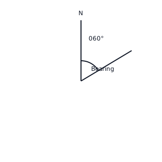
True bearings are measured clockwise from North () and are always written as three digits (e.g., or ). In 3D navigation, bearings typically represent horizontal direction on the -plane, while altitude or elevation introduces the -coordinate.
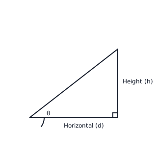
The angle of elevation is the angle between the horizontal ground plane and the line of sight looking up at an object. This creates a right-angled triangle where the vertical height and horizontal distance are related by .
To solve 3D problems, decompose the scenario into 2D triangles. Use the horizontal plane (bearings) to find ground distances and then use vertical planes (elevation/depression) to find heights or direct distances (hypotenuses).
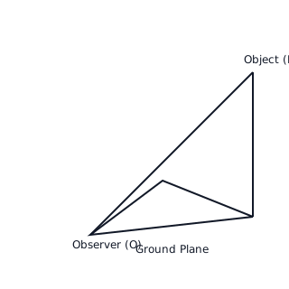
The Sine Rule and Cosine Rule are essential when the horizontal movement involves non-right-angled triangles. For a triangle with sides and opposite angles , use these to link positions before applying 3D trigonometric ratios.
📐Formulae
💡Examples
Problem 1:
An observer at point sees a drone at point . The drone is at an altitude of m. From point , the bearing of the drone is and the angle of elevation is . Calculate the horizontal distance from the observer to the point directly below the drone, and the direct distance .
Solution:
- Let be the point on the ground directly below the drone . We have a right-angled triangle where .
- The angle of elevation is . The altitude (opposite side) is m.
- Using :
- Using :
Explanation:
To solve 3D navigation problems, first identify the vertical triangle (Drone-Ground-Observer). Use the angle of elevation and the vertical height to find the horizontal distance (adjacent side) and the line-of-sight distance (hypotenuse).
Problem 2:
A ship travels from port on a bearing of for km to point . It then changes course and travels on a bearing of for km to point . Find the distance .
Solution:
- Draw the bearings. The angle between the first path and the North line is .
- At , draw a new North line. The interior angle between the path and the North line at is (consecutive interior angles).
- The bearing of from is .
- The angle .
- Since is right-angled at , use Pythagoras:
Explanation:
In 2D navigation segments of 3D problems, use the properties of parallel North lines to find the interior angles of the triangle formed by the journey. In this case, the interior angle at turned out to be , simplifying the calculation.
Problem 3:
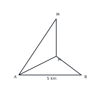
A hiker at point observes a mountain peak on a bearing of with an angle of elevation of . After walking km due East to point , the hiker finds the new bearing of the peak is . Calculate the height of the mountain peak above the level of and .
Solution:
- Let be the point on the ground directly below peak . Let be the height .
- In , .
- In the horizontal : (since East is ). (since West is ). .
- Apply Sine Rule in :
- Substitute back into the height equation:
Explanation:
We first solve the horizontal triangle on the ground using the Sine Rule to find the distance from the observer's first position to the base of the mountain. Then, we use the right-angled triangle in the vertical plane to find the height.
Problem 4:
An airplane is flying at an altitude of m. At a specific moment, it is at a bearing of from a control tower and at an angle of elevation of . An observer at point , located m due South of the tower , also views the plane. Calculate the distance from the observer at to the plane .
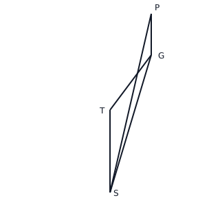
Solution:
- Let be the ground position of the plane directly below . is the horizontal distance from the tower.
- In , .
- In the horizontal plane : , , and (since is South and is at from ).
- Use Cosine Rule to find :
- Use Pythagoras in vertical to find :
Explanation:
First, find the ground projection distance using the tangent ratio. Next, use the Cosine Rule on the horizontal plane to find the distance between the observer and the point directly below the plane. Finally, apply the Pythagorean theorem in 3D (or a vertical triangle) to find the direct distance.